|
"The hill upon which Mount Pulaski is situated was the product of
the glacial age. Eons ago, when crystalline fleets from the arctic
were carrying rich cargoes of soil to what is now central Illinois,
ice-formed crafts deposited their loads of silt in isolated
places. One of these places, being on the fortieth degree of
latitude, north, and near the ninetieth degree of longitude, west, was
the 'mount' of Mount Pulaski." The surface of the country around and about Mount Pulaski is an undulating prairie. To the north, about two miles, it is the main channel of Salt Creek, a tributary of the Sangamon river. About seven miles to the south is the lake Fork of Salt Creek. In prehistoric days, Salt Creek was a considerable stream. Ferdinand Ernst, a Hanoverian traveler, who saw it in 1819 and wrote about it, called it a 'navigable stream'. The Kickapoo Indians called it the 'Onaquispasippi' or 'the river of the shell-bark hickories.' In the same days, the Lake Fork of Salt Creek was a veritable lake, covering thousands of acres at high water. At low tide, its bordering lands were marshy moors, where deer and wild fowl held high carnival. The earliest settlers were wont to hug to the timbered banks of streams, where water and wood were handily accessible. They considered the prairies, by reason of wild-grass and wind-swept fires, together with lack of shade and shelter, as negligibly habitable. When Illinois was admitted into the Union as a sovereign state in 1818, there were no white settlements in what is now Logan County. The lands in the Salt Creek valley were, and for more than a century had been, inhabited by roving bands of the Kickapoo tribe, in whom possessory title was vested. Civilization came into the Sanamon and Salt Creek valley by way of an old Indian Trial which left the Mississippi near the present site of Alton and wond out and into the heart of what is now Illinois, past the present sites of Edwardsville, Carlinville, Springfield and Lincoln and on to Lake Peoria. During the war of 1812, Gov. Edwards, of the then territory of Illinois, led a band of mounted rangers along this ancient trail, from the Mississippi to the Illinois river past Elkhart hill and across Salt Creek in what is now Logan County and the trail thereafter became know as the 'Edwards' Trace'. On July 30, 1819, the Kickapoo chieftains, more or less under duress, relinquished all their right and title to the lands in the Sangamon and Salt Creek valleys to the United States for a trifling consideration which was never met in whole. Anticipating the Kickapoo treaty and the opening to settlers of the Kickapoo land, James Latham and family, coming from Kentucky in part by way of the Edwards' Trace, located at Elkhart Hill in the spring of 1819. In the fall of the same year, Robert Musick and family located on Sugar Creek, northwest of the present site of Lincoln. The Latham and Musick settlements were the first white settlements in what is now Logan County." Judge
Lawrence B. Stringer’s “History of Mt. Pulaski” Published 1911
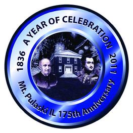
MT. PULASKI 175th
Mount Pulaski
& the Lincoln Court
by phil bertoni
History of Jabez Capps Family - co-founder of Mt. Pulaski in 1836 1878 History of Logan County - includes History of Mt. Pulaski Township 1878 Mt. Pulaski Business Directory Links to other Histories of Mt. Pulaski & Logan County The Lincoln Log- A Daily Chronology of the Life of Abraham Lincoln |